Tag Archives: River Contamination

Water quality and contaminant problems in rivers

The Polluting suburbs

Aerial view of Silver Spring, Maryland – a suburb of Washington, D.C.

Have you been to Washington D.C.? It’s a favorite tourist destination for many. Most people who visit the city confine themselves to the National Mall where the monuments and historic sites can be seen.  The downtown area is similar to other major cities, with extensive office blocks, condominiums, and small businesses like restaurants and retail stores, however Washington, D.C. is unique in never having had major industrial activity like manufacturing or refining as its economic engine is the federal government. Few who don’t live there realize the extent of the city’s surrounding suburbs. Urban sprawl stretches west to Manassas, Virginia, south to Fredericksburg, Virginia, north to Frederick and Baltimore, Maryland, and east to the Chesapeake Bay. The vast suburban enclaves wrapping themselves around the city’s core choke off the natural processes of the water cycle with their immense impervious surfaces of concrete, asphalt, and roof tiles. What is this unnatural environment doing to our precious water resources? A good look at the impact of this overdevelopment can be found in the 2019 U.S. Geological Survey (USGS) Scientific Investigation Report (2019-5092):  Sediment and Chemical Contribution Loads in Tributaries to the Anacostia River

            The Anacostia River flows through Washington, D.C. and empties into the Potomac River. The USGS study is part of a larger scientific investigation of the Anacostia River’s pollution sources.  The U.S. Environmental Protection Agency set Total Maximum Daily Load (TMDL) values for the Anacostia River in 2003 for 16 different pollutants. The goal of setting TMDLs is to make a water body comply with a determined use, which in this case is to make the Anacostia River both swimmable and fishable – a tall order even for a city without a lot of industrial activity. The few industrial sources of contamination have been identified. They consist of a power plant, a gas plant, a bulk fuel storage area, and a couple of city landfills. These sources have been studied and are well understood. Most of them now have control measures installed to prevent future pollution to the river.  Contaminated sediments in the Anacostia from these sources have been pinpointed and singled out for removal so that  they will no longer be a continuing catchment of contaminants polluting the river far into the future. However the question becomes: will the water in the Anacostia River meet the TMDLs set by the EPA after the removal of these old contaminant sources or will the urbanized environment just continue to pollute the river and make TMDLs unachievable?  In other words, can the river be made clean again? Will people ever be able to safely eat fish from the river? Will they be able to swim and recreate in the river without concern?  

            Part of the continuing pollution of the river comes from the city itself. Storm and sewer drain studies have shown how the run-off from the city’s streets and yards are contributing to the pollution of the river. See my last post on Are Cities a Point Source of Pollution (Are Cities A Point Source of Water Pollution?)  But what about the urbanized areas surrounding the city?  What are their contributions? After all the entire city is small in comparison to the larger metropolitan area. The USGS study seeks to determine what the overall pollutant loads are from the tributaries of the Anacostia. The main tributaries with the largest basins and the greatest lengths are the Northwest Branch and the Northeast Branch. These branches are the two main tributaries which join to form the Anacostia River. The sources of both branches are in Maryland. The Northwest Branch drains much of the suburban areas of Montgomery County, Maryland while the Northeast Branch flows through Prince Georges County, Maryland. Both of these counties are monolithic representations of modern living with intense suburbanization, long streets clustered with parking lots, strip malls and shopping centers, residential developments with minimum space between houses and practically no yards, highways like the famous Beltway, and schools, churches and hospitals crammed into narrow spaces. Impervious surfaces, imposed by pavement and houses through which no rainfall can penetrate, vary from 20 percent in the upper portion of the basin to 50 percent at the confluence of the two branches. Both branch basins are densely populated. About 47 square mile out of a total 122 square mile area over which the tributary basins extend are covered with residential development. There are very few parks and any forest land is limited to that found along the riparian corridors of the branches. Just 13 square miles within the basins are forested. Agricultural lands make up only12 square miles. The two branches combined provide most of the water supply for the Anacostia River – 32,900 million gallons a year. They also contribute most of the sediment and the largest amount of Polyaromatic Hydrocarbon contamination flowing into the Anacostia. The USGS calculates that 89,000 grams of PAHs flow into the Anacostia from its tributaries every year. Seventy two percent of it comes from the Northwest and Northeast Branches. This is not surprising considering the urban nature of these two tributaries and the amount of sediment they are carrying. Out of 30,500,000 kilograms of sediment contributed by all tributaries to the Anacostia, 26,000,000 kilograms is coming from the Northwest and Northeast Branch with the Northwest Branch contributing the most. Considering that contaminants are primarily transported with fine grained sediment, it is not unexpected that the greatest amount of PAH contamination is coming from these two waterways.

            Completely surprising is where the greatest amount of Polychlorinated Biphenyls (PCBs) is originating from – Lower Beaver Dam Creek. This tributary to the Anacostia originates solely from Prince Georges County, Maryland. Its basin is fairly small – 14.9 square miles – but it has an outsize contribution of sediment to the Anacostia, nearly 4,500,000 kilograms a year. This amounts to 3.01 kilograms per year for every square mile. Obviously Prince Georges County needs to put some erosion control measures into place. Entrained within the sediment is a huge load of PCBs being carried along by the water in the creek.  The PCB levels in Lower Beaver Dam Creek are magnitudes greater than any other tributary to the Anacostia. The USGS calculated that stream water in the creek has an average concentration of 130 micrograms per kilogram. Compare that to Northwest Branch with 6.6 micrograms per kilogram. About half of the creek’s basin is covered in residential development. The impervious surface is estimated to be about 32 percent or 7 square miles. Forested land makes up only 3.5 square miles and agricultural land some 6.6 square miles.  There’s also a small amount of industrial use (less than 1 square mile.)  The source of the PCBs in the creek is not known. The total annual amount of PCBs calculated by the USGS as entering the Anacostia from its tributaries is 860 grams per year, seventy five percent of that is coming from Lower Beaver Dam Creek.

             So how is this all going to affect the ability of current measures envisioned to protect the Anacostia River by removing known sources of PAHs and PCBs in the river’s sediments? And can the Anacostia River ever meet the TMDLs set by EPA? Well I suspect that’s all up in the air right now, because Northwest and Northeast Branch and Lower Beaver Dam Creek as well as a couple of smaller tributaries solely originating within Washington D.C. (Watts Branch and Hickey Run) are exceeding the contaminant load allocations set for those water bodies under TMDLs, in some cases by a factor of 200. What new measures will have to be implemented to control and reduce contaminants coming from the Anacostia River’s tributaries? And how will Washington D.C.’s environmental regulatory agency get  cooperation from another state, in this case Maryland, to implement what could be costly and possibly disruptive practices to reduce contaminants that are essentially being introduced into waterways by suburban sprawl? If you want to know then look at the Chesapeake Bay Program where currently the state of Maryland is suing states upstream of the Susquehanna River that are contributing a huge share of the contamination to the Bay and doing little to prevent it.               It’s clear from the USGS study that suburban areas, with dense populations creating extensive impervious surfaces (e.g. parking lots and streets), are a significant contributor to the contamination of streams and rivers. The runoff from paved surfaces after a rainfall is washing contaminants off suburban streets and transporting them into nearby streams. Additionally the heavy flow of water caused by runoff is eroding stream banks, resulting in a huge amount of sediment with entrained contaminants being carried downstream and into our rivers. The lack of natural rainfall percolation through soils is resulting in a new contamination source – the suburbs.   
Are Cities A Point Source of Water Pollution?

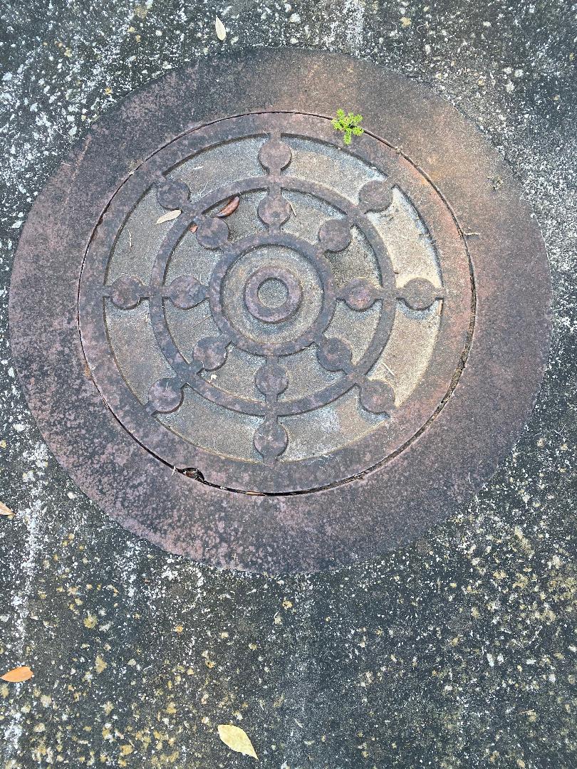
You drive over them all the time and never even notice except if they have been poorly installed or have subsided into the pavement and your car tire hits them with a thud.  Manhole covers.  They are ubiquitous in the urban environment and are covering up a multitude of sins.  Below them lurks the city sewer system.  You may have visions of sewers being filled with rats and roaches; no place that you plan to visit, just a reality of modern life.  Most of the manholes are covering the storm sewers that drain a city of rainfall and snow melt.  The storm sewers in a new suburb are not connected with the wastewater sewers that empty from your sinks and toilets, but in many of our older cities in the United States such as Washington, D.C. some of the storm sewers are combined with the wastewater sewers.  I know you are thinking “Yuck” and me too.  In Washington D.C., sixteen of these combined sewers flow directly into the Anacostia River during storm events with loads of e.coli and fecal coliform because of the lack of capacity at the wastewater treatment plant. 

            The uncombined sewers that simply deliver storm water to the Anacostia River are not benign either.  Because of the wash of water during storm events and after snow melt, the sewers transport sediment washed from roads and green spaces like yards and parks, trash including glass and metal, and leaves and other organic detritus.  The sediments contain the urbanized contaminants of the city.  A type of urban contaminant you might find in storm sewers are Polychlorinated Aromatic Hydrocarbons (PAHs) that form as a result of incomplete combustion of fossil fuels in power plant emissions but also are emitted with car and truck exhaust.  PAHs are components of asphalt and automobile tires as well.  Simple tire wear on the streets of our nations and the existence of asphalt pavement results in a polluting source of contamination to our waterways.  Polychlorinated Biphenyls (PCBs) are another urban contaminant.  PCBs were used in all sorts of electrical equipment that supports a city’s electrical power grid:  transformers, capacitors, voltage regulators, and switches.  PCBs also were used in motor and hydraulic systems, insulation, oil based paint, and a whole host of other crazy stuff that are part of the urbanized environment.  Long banned for use, they continue to persist in urbanized areas because they don’t degrade to any extent.  Dioxins which are also formed from fossil fuel combustion, pesticides such as DDT and chlordane that once were widely used throughout cities for pest control, lead from bridges, corroding metal surfaces, paint, and old combustion of lead gas, arsenic from pesticides and fertilizer used to treat wood in outdoor decks and walkways, and mercury from combustion of coal and oil in power plants are all urban contaminants.

            When storm water and snow melt clears the streets of a city, all of these urban contaminants flow into and through the sewer systems and discharge directly into our rivers.  It is hard to tell in most cities to what extent urban living is contributing to the pollution of our waterways, because in addition to city contaminants there is also the contribution of pollutants from run-off at both old and new industrial sites.  These industrial sites, if still operating, are often considered point sources of contamination under the Clean Water Act and not just from effluents that might be leaving the sites via pipes and culverts, but from storm water runoff at the property itself.   Washington, D.C. though has no large scale industrial sites contributing to the Anacostia River; there are just a few old city landfills, a couple of power operators, and a few petroleum storage areas that are part of any city’s urban legacy.  The few military bases are old, really old, (for example the Navy Yard was established in 1799) and they were not major industrial operations.   So I was excited to see as part of the Anacostia River Program, which promises to make the water in the river fishable and swimmable, a study was being conducted on the contribution of upgradient sewer systems to the contaminated sediments at outfalls flowing into the river.  Here was a chance to define to some extent what the contribution of contamination by the city itself is to the Anacostia River.  I read eagerly through the “Manhole Sediment Investigation Report” completed back in December 2019. 

            Outfalls along the Anacostia were sampled for contaminants as part of an earlier study.  Outfalls of the sewer system make little delta like formations where a pipe or culvert drains water into the river.  Sediments from 16 of the combined sewer outfalls and 35 of the storm water only outfalls are considered contaminated.  The idea of the study was to use manholes to collect sediments out of the sewers to assess the level of contamination being contributed to the river by upgradient sources.  Washington D.C.’s Department of Environment and Energy wants to clean-up the contamination in the river to achieve its goal of making the river safe for swimmers and fishermen, but is concerned about possible continuing upgradient sources of contaminants that could re-pollute the river after the cleanup. 

            One hundred fifty seven manholes upstream of the contaminated outfalls were identified for inspection. Only 38 of the manholes were actually sampled for two primary reasons: 1) many of them could not be opened, and 2) many lacked enough sediment to be chemically analyzed.  The lack of sediment in many of the sewers is not surprising because think of how storm events proceed.  A good one washes the streets clean with a torrent of water which enters a storm drain aligned with a multitude of other storm drains and the rush of water down the sewer pipe and into the river is turbulent and almost violent.  Everything is blasted out of the sewer including most of the sediment.   

     Here’s what the study concluded from the 38 samples taken.  All sewers that discharge to the Anacostia are washing contaminants into the waterway.  It wasn’t possible to directly correlate the levels of contaminants found in sediments taken from the sewers to those from the outfalls.  This is because the sediments taken from the manholes contain a much lower level of organic carbon, clay and silt than the sediments at the outfalls. Such low levels are a result of the turbulent flow that carries the small particles, of which these types of sediments are composed, out of the sewer and into the waterway.  Contaminants preferentially absorb onto organic carbon, silt, and clay.  However, where manholes provided enough sediment for chemical analysis, they were found to contain notably higher levels of contaminants compared to the background of these contaminants in the river.  Many of the contaminants from the sewers are 20 to 50 times higher than background in the river sediments. 
            Interestingly some of the highest levels of PCBs from the sewers were not where you would expect them to be – near the power generation sites – but are instead in the area upstream of the Washington Channel and Tidal Basin, where there are no known contaminated sites.

            Because of the limited sampling, the study doesn’t provide an overall picture of how much the city is contributing to the pollution of the Anacostia River, but the results are alarming enough for the study participants to recommend further upstream manhole sediment sampling to see if the sources of the contamination in the sewers can be tracked down and identified – a difficult and expensive undertaking.   It’s questionable as to whether individual sources could ever be found.  Perhaps urban contaminants are so ubiquitous in a city that vast water management measures will need to be taken similar to the ones now being implemented on the Chesapeake Bay where wide land use issues are contributing to the nitrogen and phosphate pollution.  In order to meet Clean Water standards, will cities in the future have to implement actions like rain gardens, green roofs, installation of pervious pavement, runoff controls, and water treatment at outfalls.  I suspect this small manhole sediment study has opened the eyes of many environmental regulators tasked with keeping our rivers clean of pollutants.  The study verifies that it is not just contaminated sites like landfills and power plants that are polluting our urban rivers; it is also the city itself.        

The Urban River

Anacostia River

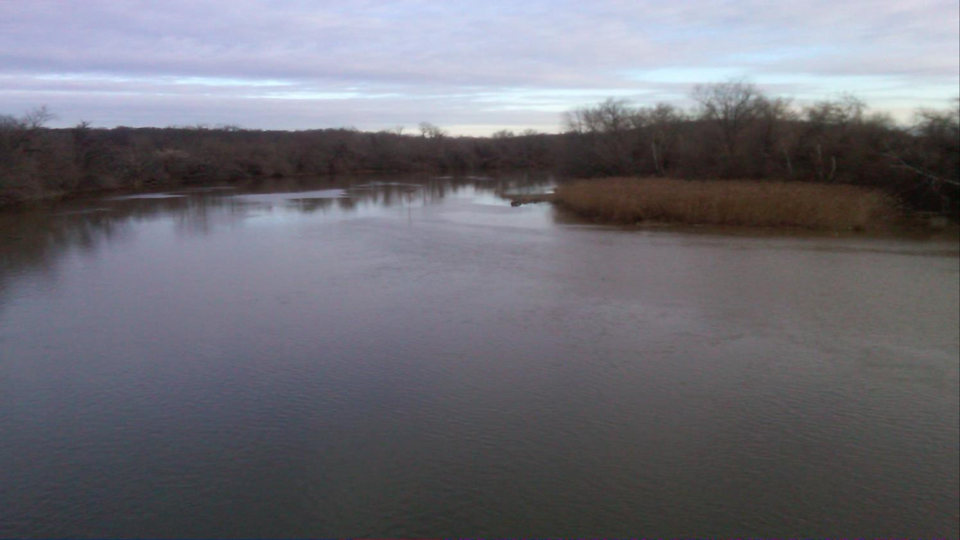
Everyday tens of thousands of commuters in eastern Maryland get into their cars and drive to their jobs in Washington D.C. (D.C.).  They most often commute into the city via New York Avenue, Benning Road N.E., or Pennsylvania Avenue.  No matter what route they take, they have to cross the Anacostia River.  Most of the commuters probably don’t know the name of the river they are driving over or even give it a second glance as they weave through some of the worst traffic congestion in the country.  It’s not a big surprise why drivers ignore the river.  It is perhaps one of the worst looking water bodies in the country.  It is a wide, flat, slow moving, reddish brown, algae matted mess barely discernible as water.    

          The Anacostia has a small watershed of 176 square miles.  However the entire extent of the watershed is within the urbanized and suburbanized confines of D.C., Montgomery County and Prince Georges County, Maryland.  The Anacostia eventually flows into the more well known Potomac River near Hains Point and the Washington Ship Channel.  The Anacostia is one of the best examples in the country of a river where most of the environmental impacts are caused by the urban environment as opposed to past industrial waste disposal practices.  Although there are a number of contaminated sites along the river, they are mostly sites associated with urban living – municipal landfills, utility companies, and petroleum storage yards.  The only odd ducks are the military bases which are present in large numbers in the country’s capital.  But the two military sites located along the Anacostia had little industrial activity and most of it was long ago.

          The river’s chief environmental problems are suspended sediment which gives it that nasty brown color, nutrients like nitrogen which cause the algal blooms, and e. coli and fecal coliform.  The latter two contaminants are pathogens. Their presence in the river is due to a combined storm and wastewater sewer system which regularly overflows the Blue Plains waste water treatment plant, dumping untreated human waste into the Anacostia River.      

          The District of Columbia’s Department of Environment and Energy (DOEE) has been monitoring the Anacostia, along with all the other water ways in its jurisdiction, for years.  The agency produces regular reports on their findings.  Their most recent report in 2016 is entitled: The District of Columbia Water Quality Assessment Draft Integrated Report.  The report provides water quality data on the state of D.C.’s rivers and streams and outlines a program the DOEE has implemented to meet the tough goal of making all water bodies in the area swimmable and fishable.  According to the report, there are no current waters in D.C. which support all designated uses.  A “designated use” is a term that is used by environmental regulators to describe the activities people should be able to engage in a water body, like fishing and swimming.  So the Anacostia River is not an outlier.  Even Rock Creek, the beautiful stream that descends through Rock Creek National Park doesn’t meet its designated use of swimming because of e.coli or its designated use of fishing because of polychlorinated biphenyls (PCBs).

          The causes for water impairment in all of the water bodies of D.C. are myriad because of the urban nature of the surrounding land. Pesticides are abundant in soils because of past widespread spraying for mosquitoes and other pests, PCBs which were once used in electric transformers are everywhere, and polycyclic aromatic hydrocarbons (PAHs) as well as oil and grease wash off of the city streets. All of these contaminants enter waterways as a result of storm water flow.

          The Anacostia River has the same problems that all the other D.C. water bodies receiving storm water runoff have.  But in addition to contamination from the storm water inputs, it also has the problems caused by the old municipal landfills, utility operations, etc.  How can the effects of the two different sources of water degradation be separated?

          This is an important question because the Anacostia is the subject of a large scale river cleanup program prompted by the National Park Service which has administrative functions given to it by Congress for the National Park land along the Anacostia River and for the banks of the tidal portion of the river.  DOEE and the National Park Service have instigated a Remedial Investigation study under the Comprehensive Environmental Response, Compensation, and Liability Act (CERCLA) more widely known by the public as the Superfund Law.  The Anacostia River is also included under the U.S. Environmental Protection Agency’s (EPA) Urban Rivers Program.  Further the Anacostia River is a target for the Chesapeake Bay Program because the excess nitrogen and e. coli from D.C.’s combined waste water and storm water sewer system is contributing to the poor water quality in the Bay.

A number of programs have been implemented to improve water quality impairments from the combined sewer system.  D.C. Water, the water system operator in the city, has a long term control plan which involves the construction of four enormous underground tunnels to hold millions of gallons of the combined sewer flow so that it doesn’t overwhelm the wastewater treatment plant.  An upgraded treatment plant is also in the works, as well as a replacement program to separate wastewater and storm water sewers.  All of these activities are costing billions of dollars and should improve water quality in the Anacostia River.

          But those activities won’t solve the problem of existing contaminants like PCBs, dioxins, and pesticides found in the sediments of the Anacostia River.  According to the Remedial Investigation conducted under CERCLA, the sediments are the chief source of human health and ecological risks posed by the river.  The risks are attributed to the exposure of invertebrates, fish, and fish larvae to the contaminated sediment.  Fish larvae which come in contact with the contaminants are impaired in their ability to survive and grow.  Fish that do survive feed on contaminated invertebrates in the river and accumulate those contaminants within their tissues.  As a result, fishermen are advised not to eat what they catch.    

          The contamination is certainly there. There are hundreds of samples of sediment and fish with evidence of the contamination, but is the contamination from the old landfills, utility operations, and military bases or is it from the urban storm water flow that comes off the city’s streets and green spaces?  At this point the Remedial Investigation provides no answer but defers the issue to a follow-up report called a Feasibility Study. 

          The Remedial Investigation says there are 15 Combined Sewer System outfalls discharging directly to the Anacostia River during storm events because of the capacity problems at the wastewater treatment plant.  In July through September of 2017 there were a total of 153 releases from these outfalls with a volume of 390 million gallons.  Sediment samples from one of the outfalls showed high level of PCB and PAH contamination.  And those are the combined sewers. There are 60 outfalls of just storm water entering the Anacostia River. The report sites all of these outfalls as a source of “urban” background contamination, resulting in the entry of PAHs, PCBs, pesticides and even some metals into the river.

          The Feasibility Study will report on manhole sampling for the combined sewer outfalls and the storm water outfalls.  These samples should provide some very interesting data on what portion of the contamination in the Anacostia River is caused as a result of urban living.  The report will be one of the few studies to examine urban contamination’s contribution to the degradation of our streams and rivers.  The EPA has been aware of the problem for years and published its first guidance way back in September of 2002 on how to establish urban background contamination when examining Superfund sites.  EPA’s regional office in the southeast and the EPA’s Office of Research and Development are currently engaged in a study to determine urban background contamination in southeastern cities.  I will be posting in the future on the results of these studies which essentially will tell us how modern living is impacting our natural resources.