
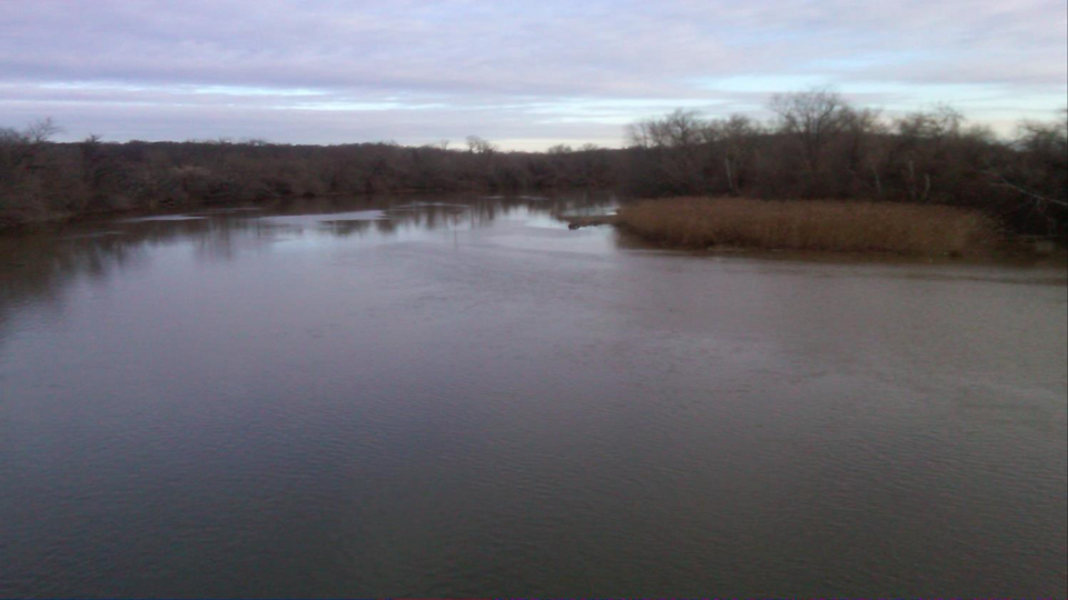
Everyday tens of thousands of commuters in eastern Maryland get into their cars and drive to their jobs in Washington D.C. (D.C.). They most often commute into the city via New York Avenue, Benning Road N.E., or Pennsylvania Avenue. No matter what route they take, they have to cross the Anacostia River. Most of the commuters probably don’t know the name of the river they are driving over or even give it a second glance as they weave through some of the worst traffic congestion in the country. It’s not a big surprise why drivers ignore the river. It is perhaps one of the worst looking water bodies in the country. It is a wide, flat, slow moving, reddish brown, algae matted mess barely discernible as water.
The Anacostia has a small watershed of 176 square miles. However the entire extent of the watershed is within the urbanized and suburbanized confines of D.C., Montgomery County and Prince Georges County, Maryland. The Anacostia eventually flows into the more well known Potomac River near Hains Point and the Washington Ship Channel. The Anacostia is one of the best examples in the country of a river where most of the environmental impacts are caused by the urban environment as opposed to past industrial waste disposal practices. Although there are a number of contaminated sites along the river, they are mostly sites associated with urban living – municipal landfills, utility companies, and petroleum storage yards. The only odd ducks are the military bases which are present in large numbers in the country’s capital. But the two military sites located along the Anacostia had little industrial activity and most of it was long ago.
The river’s chief environmental problems are suspended sediment which gives it that nasty brown color, nutrients like nitrogen which cause the algal blooms, and e. coli and fecal coliform. The latter two contaminants are pathogens. Their presence in the river is due to a combined storm and wastewater sewer system which regularly overflows the Blue Plains waste water treatment plant, dumping untreated human waste into the Anacostia River.
The District of Columbia’s Department of Environment and Energy (DOEE) has been monitoring the Anacostia, along with all the other water ways in its jurisdiction, for years. The agency produces regular reports on their findings. Their most recent report in 2016 is entitled: The District of Columbia Water Quality Assessment Draft Integrated Report. The report provides water quality data on the state of D.C.’s rivers and streams and outlines a program the DOEE has implemented to meet the tough goal of making all water bodies in the area swimmable and fishable. According to the report, there are no current waters in D.C. which support all designated uses. A “designated use” is a term that is used by environmental regulators to describe the activities people should be able to engage in a water body, like fishing and swimming. So the Anacostia River is not an outlier. Even Rock Creek, the beautiful stream that descends through Rock Creek National Park doesn’t meet its designated use of swimming because of e.coli or its designated use of fishing because of polychlorinated biphenyls (PCBs).
The causes for water impairment in all of the water bodies of D.C. are myriad because of the urban nature of the surrounding land. Pesticides are abundant in soils because of past widespread spraying for mosquitoes and other pests, PCBs which were once used in electric transformers are everywhere, and polycyclic aromatic hydrocarbons (PAHs) as well as oil and grease wash off of the city streets. All of these contaminants enter waterways as a result of storm water flow.
The Anacostia River has the same problems that all the other D.C. water bodies receiving storm water runoff have. But in addition to contamination from the storm water inputs, it also has the problems caused by the old municipal landfills, utility operations, etc. How can the effects of the two different sources of water degradation be separated?
This is an important question because the Anacostia is the subject of a large scale river cleanup program prompted by the National Park Service which has administrative functions given to it by Congress for the National Park land along the Anacostia River and for the banks of the tidal portion of the river. DOEE and the National Park Service have instigated a Remedial Investigation study under the Comprehensive Environmental Response, Compensation, and Liability Act (CERCLA) more widely known by the public as the Superfund Law. The Anacostia River is also included under the U.S. Environmental Protection Agency’s (EPA) Urban Rivers Program. Further the Anacostia River is a target for the Chesapeake Bay Program because the excess nitrogen and e. coli from D.C.’s combined waste water and storm water sewer system is contributing to the poor water quality in the Bay.
A number of programs have been implemented to improve water quality impairments from the combined sewer system. D.C. Water, the water system operator in the city, has a long term control plan which involves the construction of four enormous underground tunnels to hold millions of gallons of the combined sewer flow so that it doesn’t overwhelm the wastewater treatment plant. An upgraded treatment plant is also in the works, as well as a replacement program to separate wastewater and storm water sewers. All of these activities are costing billions of dollars and should improve water quality in the Anacostia River.
But those activities won’t solve the problem of existing contaminants like PCBs, dioxins, and pesticides found in the sediments of the Anacostia River. According to the Remedial Investigation conducted under CERCLA, the sediments are the chief source of human health and ecological risks posed by the river. The risks are attributed to the exposure of invertebrates, fish, and fish larvae to the contaminated sediment. Fish larvae which come in contact with the contaminants are impaired in their ability to survive and grow. Fish that do survive feed on contaminated invertebrates in the river and accumulate those contaminants within their tissues. As a result, fishermen are advised not to eat what they catch.
The contamination is certainly there. There are hundreds of samples of sediment and fish with evidence of the contamination, but is the contamination from the old landfills, utility operations, and military bases or is it from the urban storm water flow that comes off the city’s streets and green spaces? At this point the Remedial Investigation provides no answer but defers the issue to a follow-up report called a Feasibility Study.
The Remedial Investigation says there are 15 Combined Sewer System outfalls discharging directly to the Anacostia River during storm events because of the capacity problems at the wastewater treatment plant. In July through September of 2017 there were a total of 153 releases from these outfalls with a volume of 390 million gallons. Sediment samples from one of the outfalls showed high level of PCB and PAH contamination. And those are the combined sewers. There are 60 outfalls of just storm water entering the Anacostia River. The report sites all of these outfalls as a source of “urban” background contamination, resulting in the entry of PAHs, PCBs, pesticides and even some metals into the river.
The Feasibility Study will report on manhole sampling for the combined sewer outfalls and the storm water outfalls. These samples should provide some very interesting data on what portion of the contamination in the Anacostia River is caused as a result of urban living. The report will be one of the few studies to examine urban contamination’s contribution to the degradation of our streams and rivers. The EPA has been aware of the problem for years and published its first guidance way back in September of 2002 on how to establish urban background contamination when examining Superfund sites. EPA’s regional office in the southeast and the EPA’s Office of Research and Development are currently engaged in a study to determine urban background contamination in southeastern cities. I will be posting in the future on the results of these studies which essentially will tell us how modern living is impacting our natural resources.